 Burmese
 English


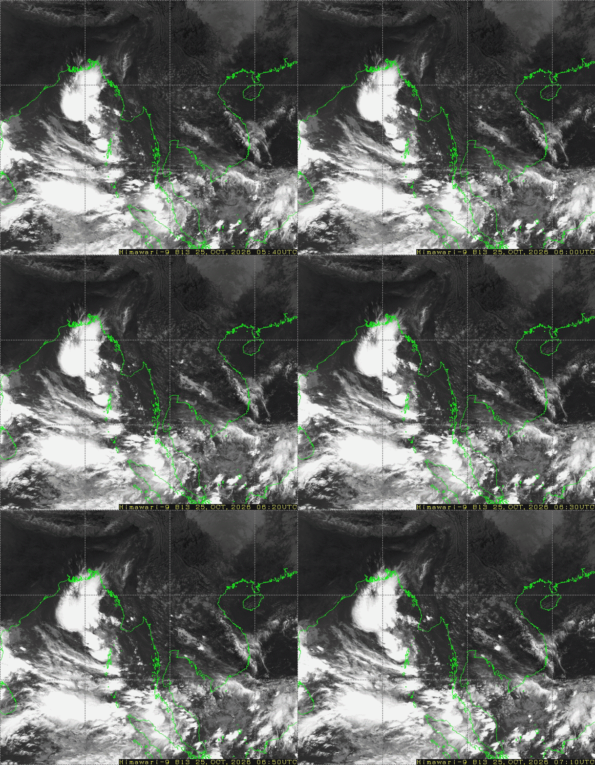
25-10-2026 According to the observations at 10:30 hrs MST today, the Depression over the Eastcentral Bay of Bengal and adjoining Southeast Bay of Bengal has move to South-Southeastwards and centered at about 140 Nautical miles West-Northwest of Coco Island(Myanmar), 480 Nautical miles East- Southeast of Visakhapatnam and 530 Nautical miles East-Southeast of Kakinada, India. Weather is a few cloud over the North Andaman Sea and partly cloudy to cloudy over the South Andaman Sea and Bay of Bengal.
Earthquake News
EARTHQUAKE NEWS
(Issued at 23:20 hour M.S.T.)
A slight earthquake of magnitude (3.6) Richter Scale with its epicenter inside Myanmar (about (17) miles southwest of Homalin ) latitude 24.68°N, longitude 94.78°E, depth (35) kilometers about (44) miles northeast of Tamu seismological observatory was recorded at (22)hr (52)min (06)sec M.S.T. on 17th February, 2018.
EARTHQUAKE NEWS
(Issued at 08:30 hour M.S.T.)
A slight earthquake of magnitude (4.6) Richter Scale with its epicenter inside Myanmar (about (6) miles east of Hmawbi), latitude 17.13 °N, longitude 96.10°E, depth (7) kilometers about (19) miles north-northwest of Kaba-Aye seismological observatory was recorded at (08)hr (08)min (25)sec M.S.T. on 17th February, 2018.
EARTHQUAKE NEWS
(Issued at 14း15 hour M.S.T.)
A slight earthquake of magnitude (4.9) Richter Scale with its epicenter inside Myanmar (about (9) miles southeast of Pyay ) latitude 18.71°N, longitude 95.29°E, depth (80) kilometers about (90) miles north of Nay Pyi Taw seismological observatory was recorded at (13)hr (44)min (02)sec M.S.T. on 14th February, 2018.
EARTHQUAKE NEWS
A moderate earthquake of magnitude (5.6) Richter Scale with its epicenter outside Myanmar (Andaman Islands, India Region), latitude 12.30°N, longitude 92.87°E, depth (58)kilometers about (383) miles southwest of Kaba-Aye seismological observatory was recorded at (09)hr (09)min (50)sec M.S.T on 13th February, 2018.
EARTHQUAKE NEWS
(Issued at 11:30 hour M.S.T.)
A slight earthquake of magnitude (4.6) Richter Scale with its epicenter inside Myanmar (about (17) miles south-southwest of Thandwe), latitude 18.22 °N, longitude 94.31 °E, depth (39) kilometers about (149) miles southeast of Sittwe seismological observatory was recorded at (11)hr (11)min (44)sec M.S.T. on 9th February, 2018.
EARTHQUAKE NEWS
A slight earthquake of magnitude (4.5) Richter Scale with its epicenter inside Myanmar (about (16) miles southwest of Phyu), latitude 18.33°N, longitude 96.26°E, depth (10)kilometers about (100) miles south of Naypyitaw seismological observatory was recorded at (23)hr (08)min (04)sec M.S.T on 7th February, 2018.
EARTHQUAKE NEWS
A slight earthquake of magnitude (4.4) Richter Scale with its epicenter inside Myanmar (about (15) miles southwest of Phyu), latitude 18.36°N, longitude 96.25°E, depth (5)kilometers about (98) miles south of Naypyitaw seismological observatory was recorded at (22)hr (47)min (41)sec M.S.T on 7th February, 2018.
EARTHQUAKE NEWS
(Issued at 02:45 hour M.S.T.)
A slight earthquake of magnitude (3.8) Richter Scale with its epicenter inside Myanmar (about (20) miles south-southwest of Kale), latitude 22.91 °N, longitude 93.96 °E, depth (10) kilometers about (30) miles northeast of Hakha seismological observatory was recorded at (02)hr (28)min (06)sec M.S.T. on 7th February, 2018.
EARTHQUAKE NEWS
(Issued at 22:45 hour M.S.T.)
A strong earthquake of magnitude (6.2) Richter Scale with its epicenter outside Myanmar (Taiwan Region), latitude 24.16°N, longitude 121.78°E, depth (10) kilometers about (1670) miles east-northeast of Naypyitaw seismological observatory was recorded at (22)hrs (20)mins (43)secs M.S.T. on 6th February, 2018.







 R E P O R T S

