၁၀-၆-၂၀၂၆ ကပ္ပလီပင်လယ်ပြင်နှင့် ဘင်္ဂလားပင်လယ်အော်တို့တွင် မုတ်သုံလေ အားကောင်း နေပါသည်။ ကပ္ပလီပင်လယ်ပြင်နှင့် ဘင်္ဂလားပင်လယ်အော်တို့တွင် တိမ်အသင့်အတင့်မှ တိမ်ထူထပ်နေပါသည်။
- အဖွင့်စာမျက်နှာ
-
ခန့်မှန်းချက်
- နေ့စဉ်မိုးလေဝသခန့်မှန်းချက်
- ၁၀ရက်ပတ် မိုးလေဝသခန့်မှန်းချက်
- လပတ်မိုးလေဝသခန့်မှန်းချက်
- နေ့စဉ်ဇလဗေဒခန့်မှန်းချက်
- ၁၀ရက်ပတ် ဇလဗေဒခန့်မှန်းချက်
- လပတ် ဇလဗေဒခန့်မှန်းချက်
- မိုးဦး၊မိုးလယ်၊မိုးနှောင်း/ဆောင်းရာသီကာလ ယေဘုယျ မိုးလေ၀သခန့်မှန်းချက်
- မိုးဦး၊မိုးလယ်၊မိုးနှောင်း/ဆောင်းရာသီကာလ ယေဘုယျ ဇလဗေဒခန့်မှန်းချက်
- ပင်လယ်ပြင်ခရီး မိုးလေဝသခန့်မှန်းချက်
- (၃)ရက်အတွက် မြို့ကြီးများ၏ အမြင့်ဆုံးအပူချိန်၊ အနိမ့်ဆုံးအပူချိန်နှင့် မိုးလေဝသခန့်မှန်းချက်များ
- တိုင်းဒေသကြီးနှင့် ပြည်နယ်များ၏ မြို့ကြီးများအတွက် မိုးလေဝသခန့်မှန်းချက်
- အယ်နီညို/လာနီညာ
- WFR Model ခန့်မှန်းချက်
- သတိပေးချက်
- ထုတ်ပြန်ချက်
- သတင်းများ
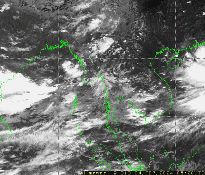
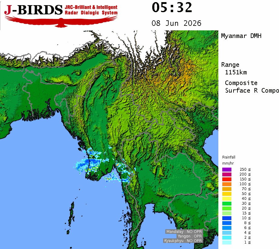
- ဂြိုဟ်တုတိမ်ပုံ
- မိုး/ ဇလ ဌာနအကြောင်း
- သဘာဝဘေး အန္တရာယ်
- လူထုပညာပေး
- ဆက်သွယ်ရန်