27-10-2025:According to the observations at 05:30 hrs MST today, the Deep Depression over Southeast Bay of Bengal has moved West-Northwestwards and intensified into the Cyclonic Storm “MONTHA” over the Southwest Bay of Bengal. It is centered at about 485 Nautical miles West-Southwest of Coco Island (Myanmar), 310 Nautical miles East-Southeast of Chennai(India), 350 Nautical miles Southeast of Kakinada (India). It is likely to move West-Northwestwards and may intensify Severe Cyclonic Storm may form on 28-10-2025 and may cross Andhra Pradesh Coast on that night. Weather is a few cloud to partly cloudy over the Andaman Sea and North Bay, Eastcentral Bay of Bengal and cloudy elsewhere over the Bay of Bengal.

Well Marked Low Pressure Area Condition

Well Marked Low Pressure Area Condition

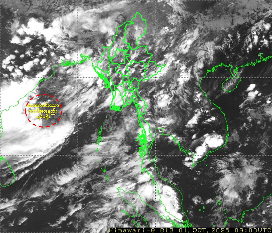
    Issued at 16:00 hours M.S.T on 1-10-2025

According to the observations at 15:30 hrs MST today, the well marked low pressure area over the Westcentral Bay of Bengal has moved North-Northwestwards and still persists. It is likely to continue to move North-Northwestwards and further intensify into a depression during next 12 hours. Thereafter, it may further intensify into a deep depression and may cross into the South Odisha-North Andhra Pradesh coasts on 2-10-2025.