Depression News, No.1, 2025
Issued at 19:00 hours M.S.T on 1-10-2025
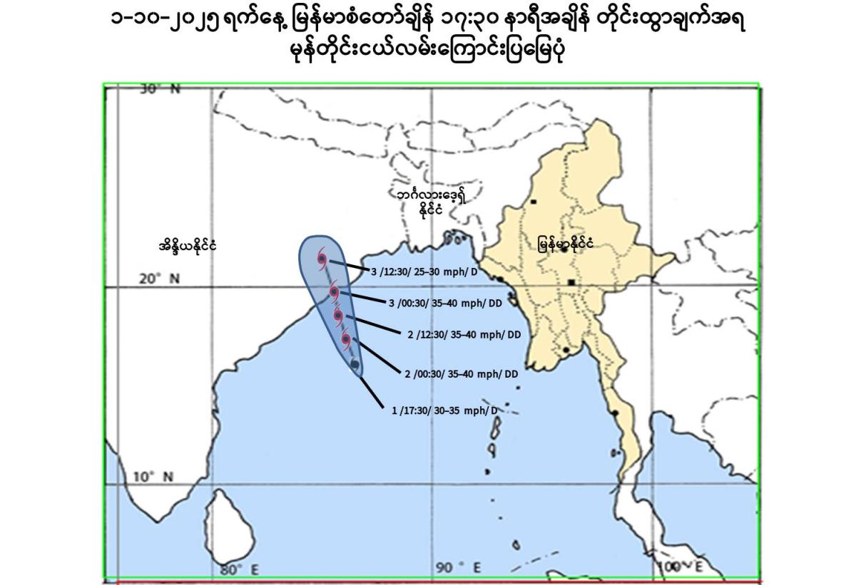
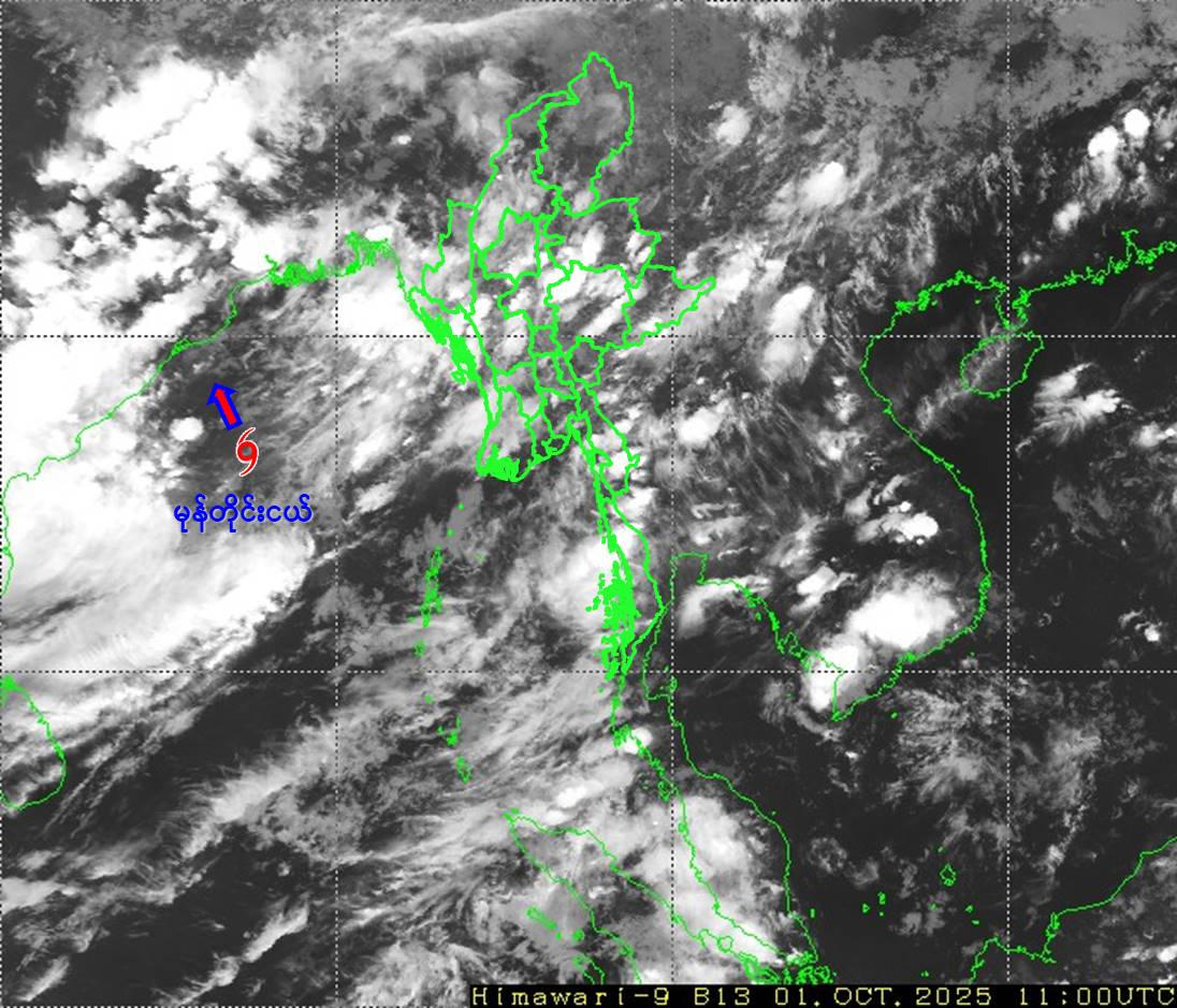
Depression Condition
According to the observations at 17:30 hrs MST today, the Well Marked Low Pressure Area over Westcentral Bay has moved North- Northwestwards and further intensified into a depression. It is centered at about 450 Nautical miles West-Southwest of Sittwe (Myanmar), 240Nautical miles South of Puri, 230 Nautical miles South of Gopalpur and 270 Nautical miles South of Paradip(India). It does not intend to move towards Myanmar coasts at the present stage and therefore the Depression is coded as yellow stage.
Position of Depression, center pressure and wind
The Depression is located at Latitude 15.8 degree North and Longitude 86.5 degree East, centre pressure of Depression is 1002 hPa and maximum wind speed near the center is 30 miles per hour at 17:30 hrs MST today.
Next 48 hours forecast
It is likely to continue to move north-northwestwards, intensify further into a deep depression and cross Odisha and adjoining Andhra Pradesh coasts between Gopalpur and Paradip arround 3-10-2025. Due to the depression rain or thundershowers will be fairly widespread to widespread in Naypyitaw, Yangon, Mandalay, Bago, Magway, Sagaing, Ayeyarwady, Taninthayi Regions and Kachin, Kayah, Kayin, Chin, Mon, Rakhine, Shan States with isolated heavyfalls in some Regions and States from tonight to next 24 hours. Occassional squalls with rough sea will be experienced Deltaic, off and along Rakhine Coasts. Surface wind speed in squalls may reach 35 mph. Wave height will be about 10-12 feet in Deltaic, off and along Rakhine Coasts. Squalls with moderate to rough sea are likely at times in Gulf of Mottama, off and along Mon-Taninthayi Coasts. Surface wind speed in squalls may reach 25-30 mph. Wave height will be about 8-10 feet in Gulf of Mottama, off and along Mon-Taninthayi Coasts.
Advisory
People should be awared the natural disasters such as the heavy rainfall with strong wind, thunder, Lightning strike, lightning, hails, flash flood and landslide in the hilly areas and near small rivers and to make necessary preparations for inland water transport, domestic flight and irrigation dams.