Cyclonic Storm “MONTHA” News, No.9, 2025
Issued at 07:00 hours M.S.T on 28-10-2025
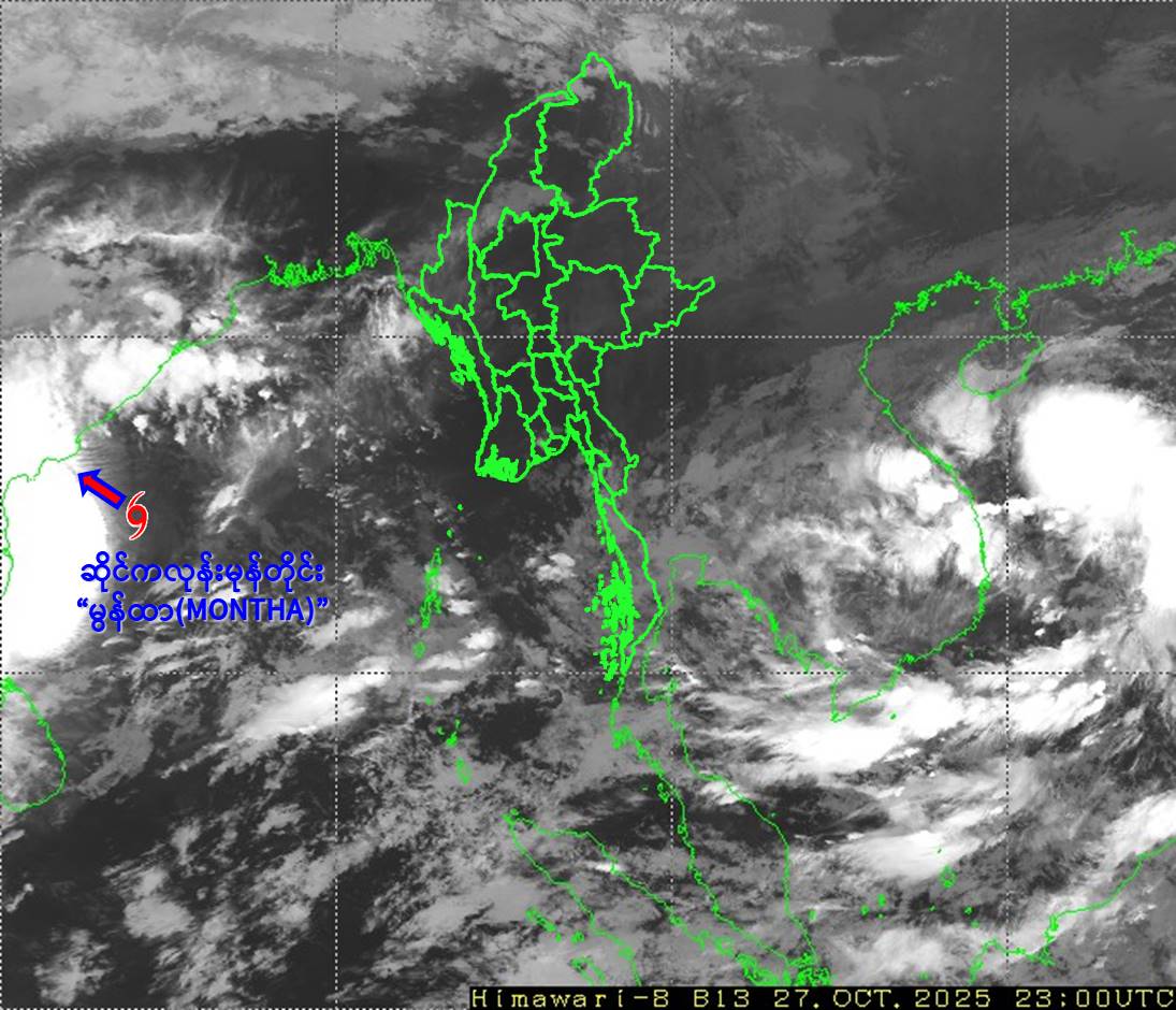
Cyclonic Storm “MONTHA” Condition
According to the observations at 05:30 hrs MST today, the Cyclonic Storm “MONTHA” over the Southwest Bay and adjoining Westcentral Bay of Bengal has moved North-Northwestwards and reached over the Westcentral Bay of Bengal still persists. It is centered at about 585 Nautical miles West of Coco Island (Myanmar), 195 Nautical miles East-Northeast of Chennai(India), 160 Nautical miles South-Southeast of Kakinada (India).
It does not intend to move towards Myanmar coasts at the present stage and therefore the Cyclonic Storm is coded as yellow stage.
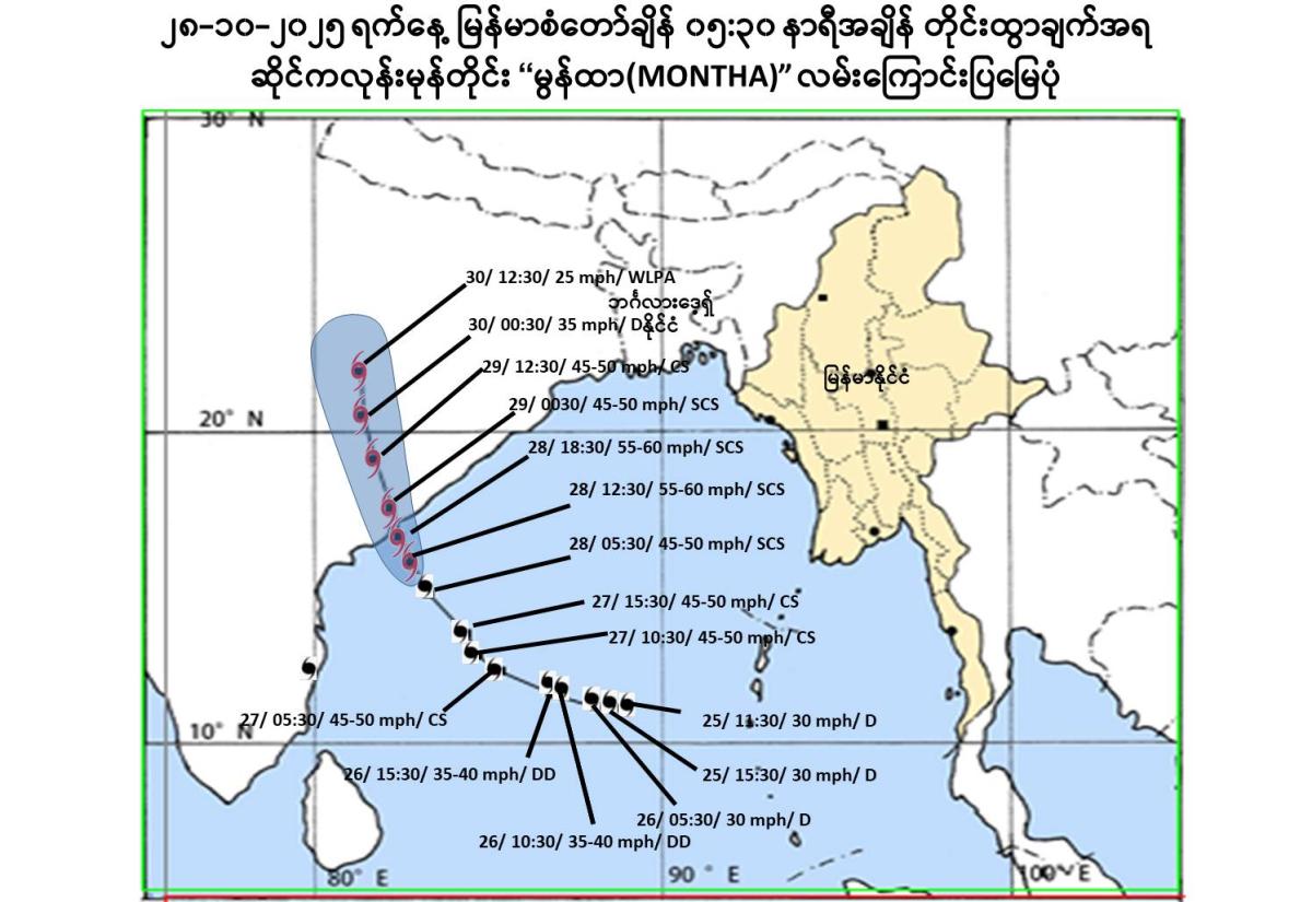
Position of Cyclonic Storm, center pressure and wind
The Cyclonic Storm is located at Latitude 14.5 degree North and Longitude 83.3 degree East, centre pressure of Cyclonic Storm is 996 hPa and maximum wind speed near the center is 45-50 miles per hour at 05:30 hrs MST today.
Next 24 hours forecast
It is likely continue to move North-Northwestwards and intensify into Severe Cyclonic Storm during next 6 hours and cross Andhra Pradesh Coast during next 24 hours.
Due to the Cyclonic Storm, rain or thundershowers will be scattered to fairly widespread in Yangon, Bago, Ayeyarwady, Taninthayi Regions and Kayin, Mon, Rakhine States and isolated in Naypyitaw, Mandalay, Magway, Sagaing Regions and Kachin, Kayah, Chin, Shan States from this morning to next 24 hours. Squalls with rough seas are likely at times in Deltaic, off and along Rakhine Coasts. Surface wind speed in squalls may reach 30-35 mph. Wave height will be about 9-11 feet in Deltaic, off and along Rakhine Coasts.
Advisory
People should be awared the natural disasters such as the heavy rainfall with strong wind, thunder, Lightning strike, lightning, hails, flash flood and landslide in the hilly areas and near small rivers and to make necessary preparations for inland water transport, domestic flight and irrigation dams.