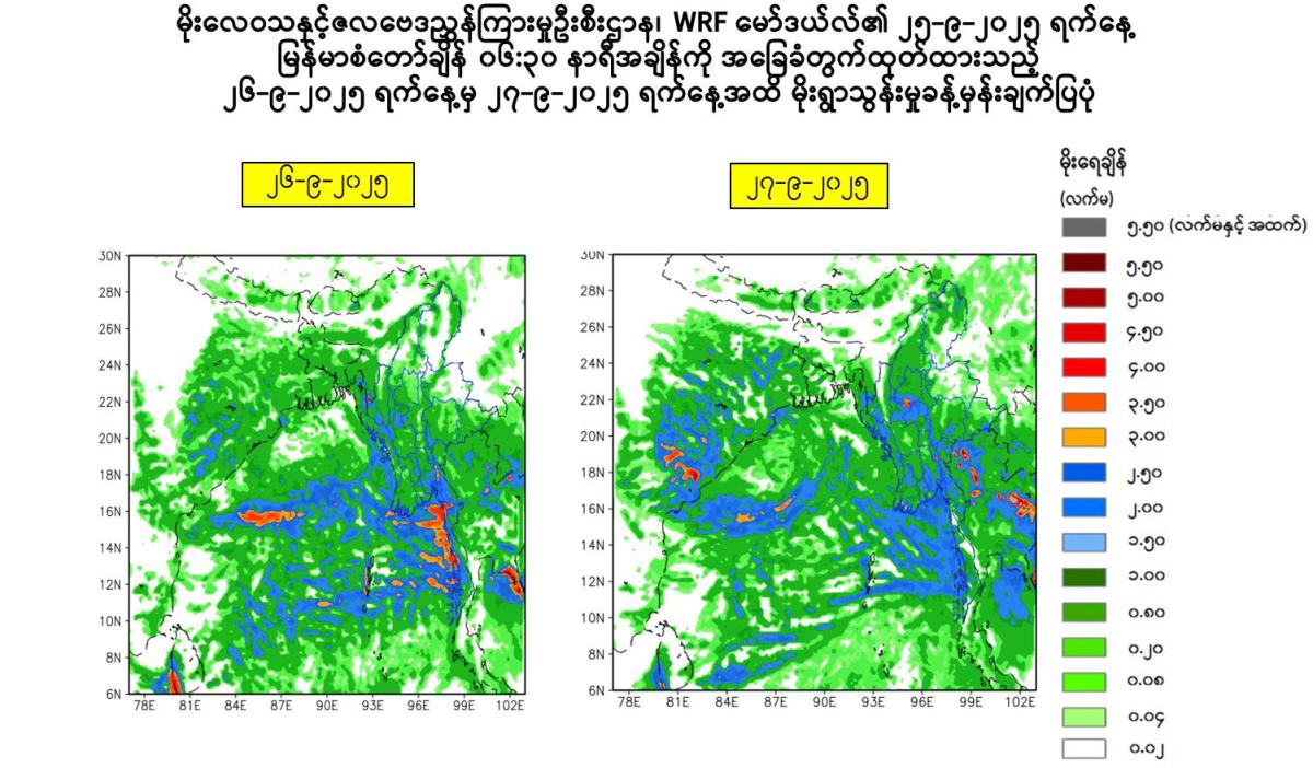
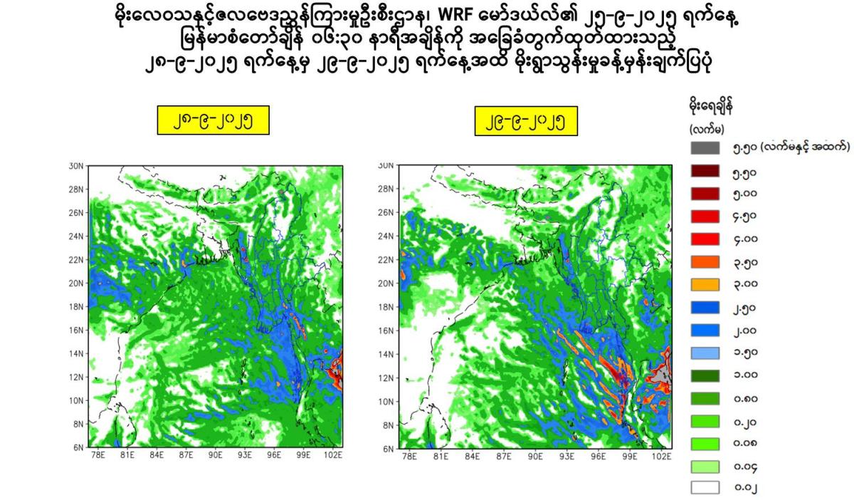
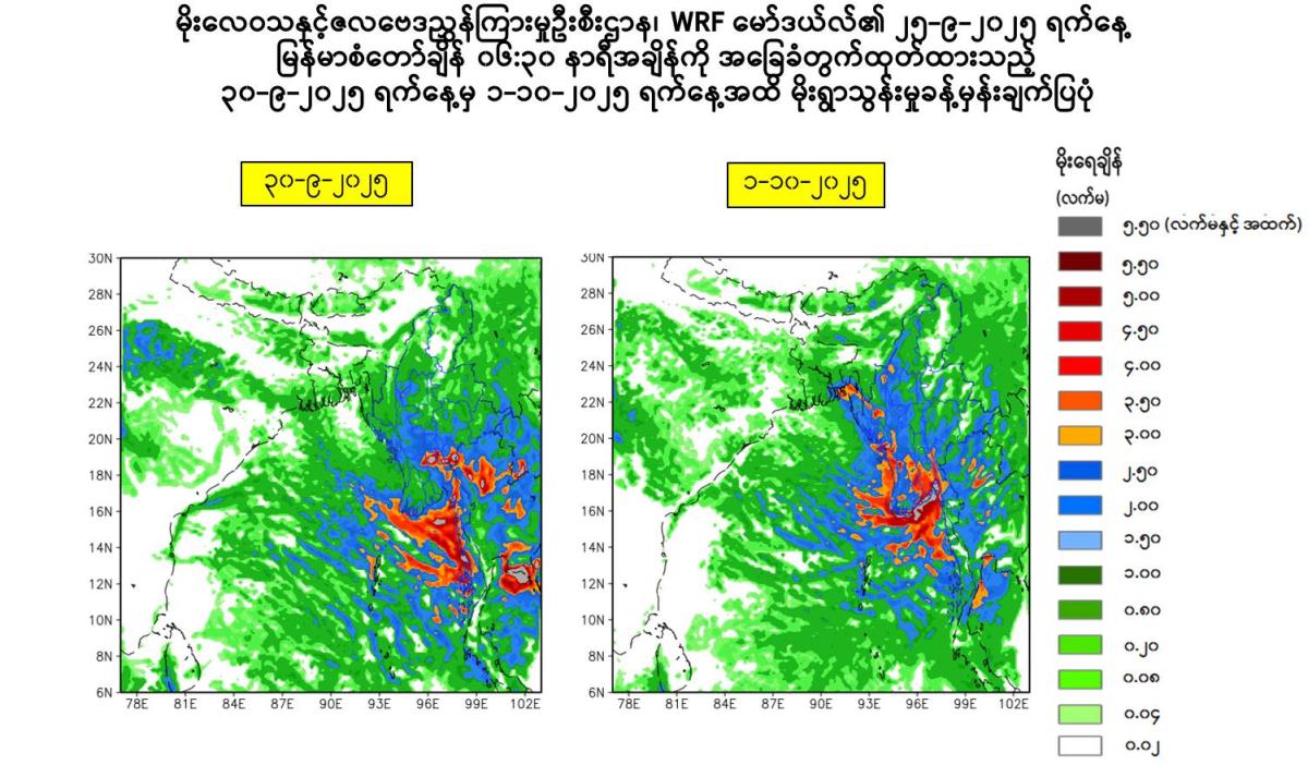
Special Weather News
Issued at 16:00 hours M.S.T on 25-9-2025
According to the observations at 15:30 hrs MST today, due to the strong monsoon over the Andaman Sea and Bay of Bengal, due to the unstable air condition over the Andaman Sea and Bay of Bengal, due to the reminant of cloud from the Tropical Depression still crossing to the Northern part of Vietnam, rain or thundershowers will be scattered in Upper Sagaing Region and Kachin, Northern Shan States and fairly widespread to widespread in Naypyitaw, Yangon, Mandalay, Bago, Magway, Lower Sagaing, Ayeyarwady, Taninthayi Regions and Kayah, Kayin, Chin, Mon, Rakhine, (Southern and Eastern)Shan States with regionally and isolated heavyfalls in Naypyitaw, Yangon, Mandalay, Bago, Magway, Lower Sagaing, Ayeyarwady, Taninthayi Regions and Kayah, Kayin, Mon, Rakhine, Southern Shan States during today evening to 1-10-2025. Occasional squalls with rough seas will be experienced off and along Myanmar Coasts. Surface wind speed in squalls may reach 35 mph. Wave height will be about 10-12 feet off and along Myanmar Coasts.
Advisory
People should be awared the natural disasters such as the heavy rainfall with strong wind, thunder, Lightning strike, lightning, hails, flash flood and landslide in the hilly areas and near small rivers and to make necessary preparations for inland water transport, domestic flight and irrigation dams.