27-11-2025:According to the observations at 10:30 hrs MST today, the Cyclonic Storm “SENYAR” over Northeast of Indonesia and adjoining the Strait of Malacca has moved East-Southeast and downgraded into a Deep Depression. It is centered at about 380 Nautical miles South of Kawthaung (Myanmar), 120 Nautical miles South-Southwest of Penang(Malaysia), 150 Nautical miles Southeast of Kuta Makmur(Indonesia) and  495 Nautical miles Southeast of Car Nicobar (India). It is likely continue to move Eastwards and weaken into a depression during next 12 hours. According to the observations at 10:30 hrs MST today, the Depression over the Southwest Bay of Bengal and adjoining Sri Lanka Coast has moved North-Northwest and intensified into a Deep Depression.  It is centered at about 800 Nautical miles South-Southwest of Coco Island (Myanmar), 150 Nautical miles South-Southeast of Tricomalee(Srilanka), 370 Nautical miles South-Southeast of Puducherry(India). It is likely to move North-Northwestwards and further intensify into a Cyclonic Storm during next 12 hours. Thereafter, it is likely continue to move North-Northwestwards and towards North Tamil Nadu and adjoining South Andhra Pradesh coasts. Weather is a few cloud over the North Bay and Central Bay and partly cloudy to cloudy over the Andaman Sea and elsewhere over the Bay of Bengal.

WRF MODEL OUTPUTS Issued on (28.11.2023)

WRF MODEL OUTPUTS

Issued on (28.11.2023)

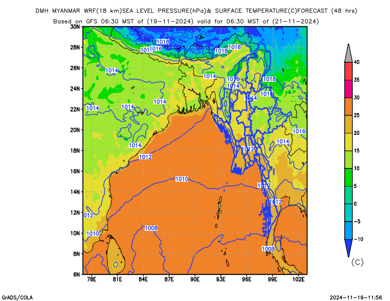
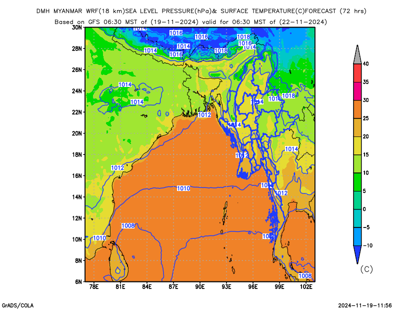
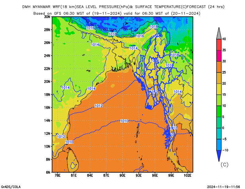
Forecast for Surface Temperature & Pressure

Forecast for Rainfall

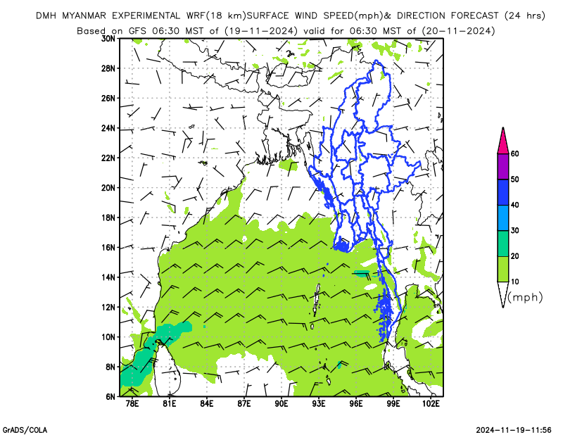
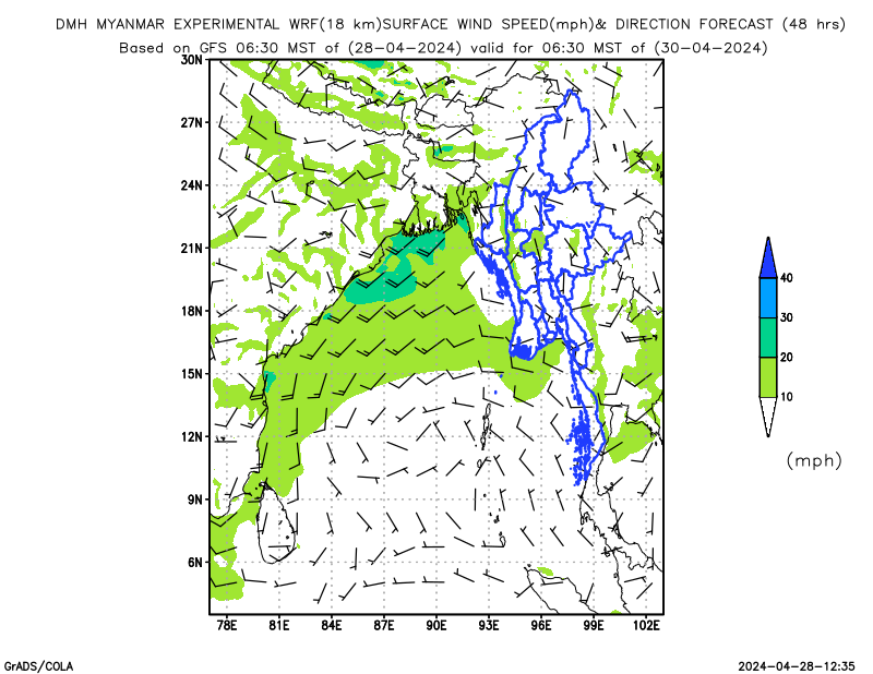
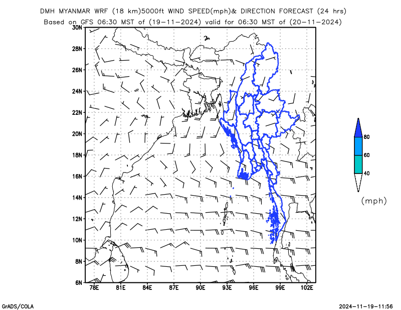
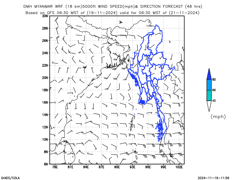
Forecast for Wind Direction & Speed
Surface

850 hPa

700 hPa

500 hPa

400 hPa

300 hPa

250 hPa

Forecast for Maximum Temperature

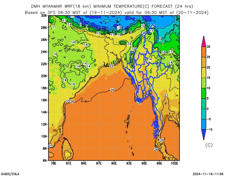
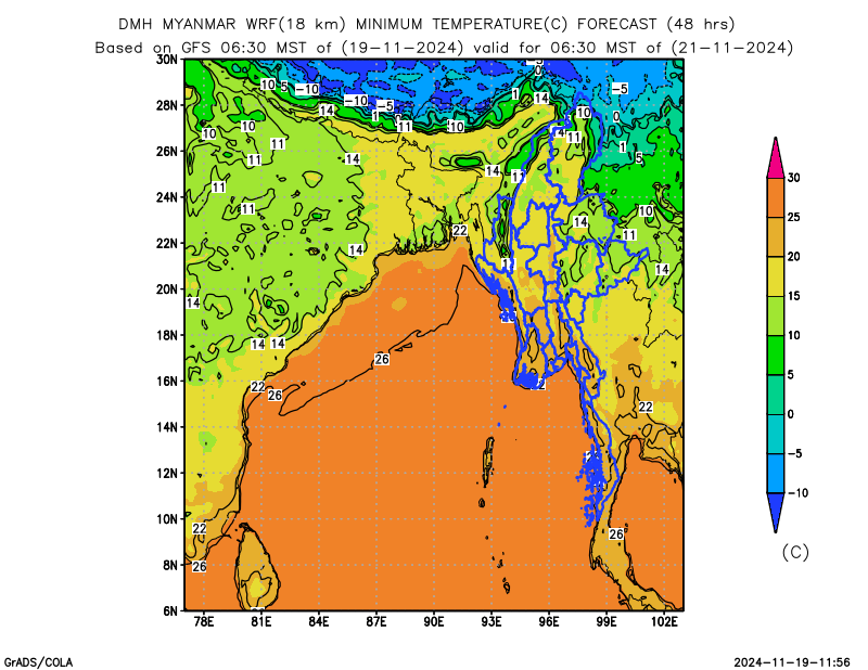
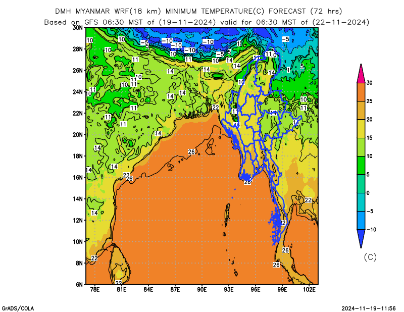
Forecast for Minimum Temperature